Functions | |
| def | add_node (x, y, z=0.0) |
| def | create_way (node_ids, tags) |
| def | create_lanelet (left_id, right_id, tags) |
| def | create_vector_map (filename, total_length, lane_width, points_per_meter) |
Variables | |
| string | geo_reference = "+proj=tmerc +lat_0=0 +lon_0=0 +k=1 +x_0=0 +y_0=0 +datum=WGS84 +units=m +no_defs" |
| proj = Proj(geo_reference) | |
| transformer = Transformer.from_proj(proj, "epsg:4326", always_xy=True) | |
| int | node_id = 1000000 |
| int | way_id = 1000 |
| int | relation_id = 100 |
| nodes | |
| ways | |
| relations | |
| parser = argparse.ArgumentParser(description="Create a vector map with two parallel lanes.") | |
| type | |
| str | |
| default | |
| help | |
| float | |
| int | |
| args = parser.parse_args() | |
Detailed Description
This script creates a vector map with two parallel lanes using the Lanelet2 library and saves it as an OSM file.
The script can be run from the command line with the following arguments:
- filename: The output filename for the vector map.
- total_length: The length of the lanes (default is 50.0).
- lane_width: The width of the lanes (default is 3.7).
- points_per_meter: The number of points per meter (default is 5).

Dependencies:
- lanelet2: The Lanelet2 library for handling lanelet maps.
- argparse: For parsing command line arguments.
Usage:
    python3 create_two_lane_map.py --filename output.osm --total_length <total_length> --lane_width <lane_width> --points_per_meter <points_per_meter>
Function Documentation
◆ add_node()
| def create_two_lane_map.add_node | ( | x, | |
| y, | |||
z = 0.0 |
|||
| ) |
Definition at line 35 of file create_two_lane_map.py.
References str.
Referenced by create_vector_map().
◆ create_lanelet()
| def create_two_lane_map.create_lanelet | ( | left_id, | |
| right_id, | |||
| tags | |||
| ) |
Definition at line 57 of file create_two_lane_map.py.
References str.
Referenced by create_vector_map().
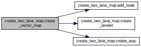
◆ create_vector_map()
| def create_two_lane_map.create_vector_map | ( | filename, | |
| total_length, | |||
| lane_width, | |||
| points_per_meter | |||
| ) |
Create a vector map with two parallel lanes.
Inputs:
- filename: The output filename for the vector map.
- total_length: The length of the lanes.
- lane_width: The width of the lanes.
- points_per_meter: The number of points per meter.
Definition at line 68 of file create_two_lane_map.py.
References add_node(), create_lanelet(), create_way(), and int.
◆ create_way()
| def create_two_lane_map.create_way | ( | node_ids, | |
| tags | |||
| ) |
Definition at line 46 of file create_two_lane_map.py.
References str.
Referenced by create_vector_map().
Variable Documentation
◆ args
| create_two_lane_map.args = parser.parse_args() |
Definition at line 148 of file create_two_lane_map.py.
◆ default
| create_two_lane_map.default |
Definition at line 144 of file create_two_lane_map.py.
◆ float
| create_two_lane_map.float |
◆ geo_reference
| string create_two_lane_map.geo_reference = "+proj=tmerc +lat_0=0 +lon_0=0 +k=1 +x_0=0 +y_0=0 +datum=WGS84 +units=m +no_defs" |
Definition at line 23 of file create_two_lane_map.py.
◆ help
| create_two_lane_map.help |
Definition at line 144 of file create_two_lane_map.py.
◆ int
| create_two_lane_map.int |
Definition at line 147 of file create_two_lane_map.py.
Referenced by speedharm_auto_configure.assign_algorithm(), speedharm_auto_configure.assign_experiment(), route::RouteGeneratorWorker.composeRouteMarkerMsg(), RouteCreation_CSV2Yaml.convertCSVToRouteFile(), create_vector_map(), platooning_strategic_ihp::PlatooningManager.getDynamicLeader(), guidance::GuidanceWorker.handle_on_activate(), route::Route.handle_on_activate(), process_traj_logs.index_plot_with_slider(), process_bag.index_plot_with_slider(), sci_strategic_plugin::SCIStrategicPlugin.plan_maneuvers_callback(), speedharm-cli.process_assign_algorithm(), speedharm-cli.process_assign_experiment(), and process_traj_logs.xy_scatter_with_slider().
◆ node_id
| int create_two_lane_map.node_id = 1000000 |
Definition at line 30 of file create_two_lane_map.py.
◆ nodes
| create_two_lane_map.nodes |
Definition at line 33 of file create_two_lane_map.py.
◆ parser
| create_two_lane_map.parser = argparse.ArgumentParser(description="Create a vector map with two parallel lanes.") |
Definition at line 143 of file create_two_lane_map.py.
◆ proj
| create_two_lane_map.proj = Proj(geo_reference) |
Definition at line 26 of file create_two_lane_map.py.
◆ relation_id
| int create_two_lane_map.relation_id = 100 |
Definition at line 32 of file create_two_lane_map.py.
◆ relations
| create_two_lane_map.relations |
Definition at line 33 of file create_two_lane_map.py.
Referenced by route_following_plugin::RouteFollowingPlugin.isLaneChangeNeeded().
◆ str
| create_two_lane_map.str |
Definition at line 144 of file create_two_lane_map.py.
Referenced by add_node(), create_lanelet(), carma_src.create_ros2_tracing_action(), create_way(), environment.generate_launch_description(), approaching_emergency_vehicle_plugin::ApproachingEmergencyVehiclePlugin.generateApproachingErvStatusMessage(), process_bag.index_plot_with_slider(), speedharm_auto_configure.log(), speedharm_auto_configure.main(), ros2_rosbag.record_ros2_rosbag(), reindex_active_rosbags.reindex_bag_files(), lanelet::MapConformer::anonymous_namespace{MapConformer.cpp}.startswith(), traffic_incident_parser::TrafficIncidentParserWorker.stringParserHelper(), carma_cooperative_perception.to_string(), and RouteCreation_CSV2Yaml.waypointAsYAMLString().
◆ transformer
| create_two_lane_map.transformer = Transformer.from_proj(proj, "epsg:4326", always_xy=True) |
Definition at line 27 of file create_two_lane_map.py.
◆ type
| create_two_lane_map.type |
Definition at line 144 of file create_two_lane_map.py.
Referenced by frame_transformer::Node.build_transformer(), lanelet::MapConformer::anonymous_namespace{MapConformer.cpp}.buildControlLine(), route_following_plugin::RouteFollowingPlugin.bumper_pose_cb(), platooning_strategic_ihp::PlatooningStrategicIHPPlugin.composeMobilityOperationLeader(), platooning_strategic_ihp::PlatooningStrategicIHPPlugin.composeMobilityOperationLeadWithOperation(), lanelet::MapConformer::anonymous_namespace{MapConformer.cpp}.getChangeType(), and arbitrator.maneuver_type_to_string().
◆ way_id
| int create_two_lane_map.way_id = 1000 |
Definition at line 31 of file create_two_lane_map.py.
◆ ways
| create_two_lane_map.ways |
Definition at line 33 of file create_two_lane_map.py.